
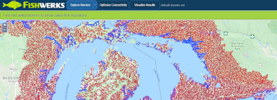
Fishwerks
This tool identifies barriers to fish migration in the Great Lakes basin and helps target the best candidates for removal. The goal is to work across jurisdictions to coordinate barrier removal and most efficiently achieve the greatest increase in fish habitat.
McIntyre Lab at the University of Wisconsin Center for Limnology and the Optimization Group at the Wisconsin Institute for Discovery
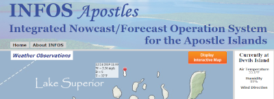
Integrated Nowcast/Forecast Operation System (INFOS)
INFOS combines real-time observations from various sources to create nowcasts and forecasts that help visitors to the Great Lakes make safe decisions about swimming and other water sports.
Department of Civil and Environmental Engineering, UW-Madison